Connected Spatial Intelligence: 4D Mine Visualisation Software
See your operational data where it happened. Drill holes, dig blocks, equipment and production on the mine surface, at any point in time.
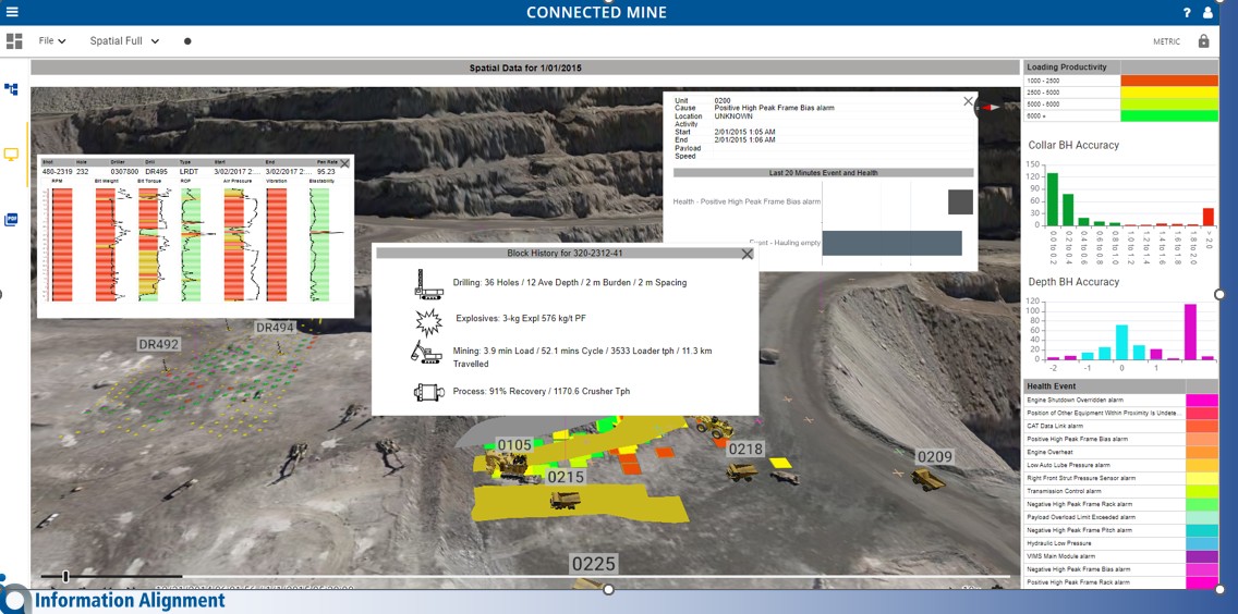

See your operational data where it happened. Drill holes, dig blocks, equipment and production on the mine surface, at any point in time.
Every load, hole and block has coordinates, but most mine reporting is a table. Connected Spatial Intelligence adds the place and the time back, so complex issues can be analysed in context and anyone can understand what happened on the ground.
Spatial views run on the same validated data as the rest of Connected Mine, so every object on the map links back to its records.
A 3D representation of the mine surface at a point in time, updated in part or in full from survey, drone or other sources.
Mining blocks and block models displayed in the pit, with links to the transactions behind them.
Equipment animated from GPS coordinates, linked to the operational records at that point in time.
Summary arrows that show overall material movement: tonnes, direction and distance.
Current or historical measurements from Connected Process Performance shown at the location they were taken.
Open the same 4D view on a desktop PC, a tablet or in any web browser.
Every hole on the surface it was drilled into, coloured by what the drill measured.
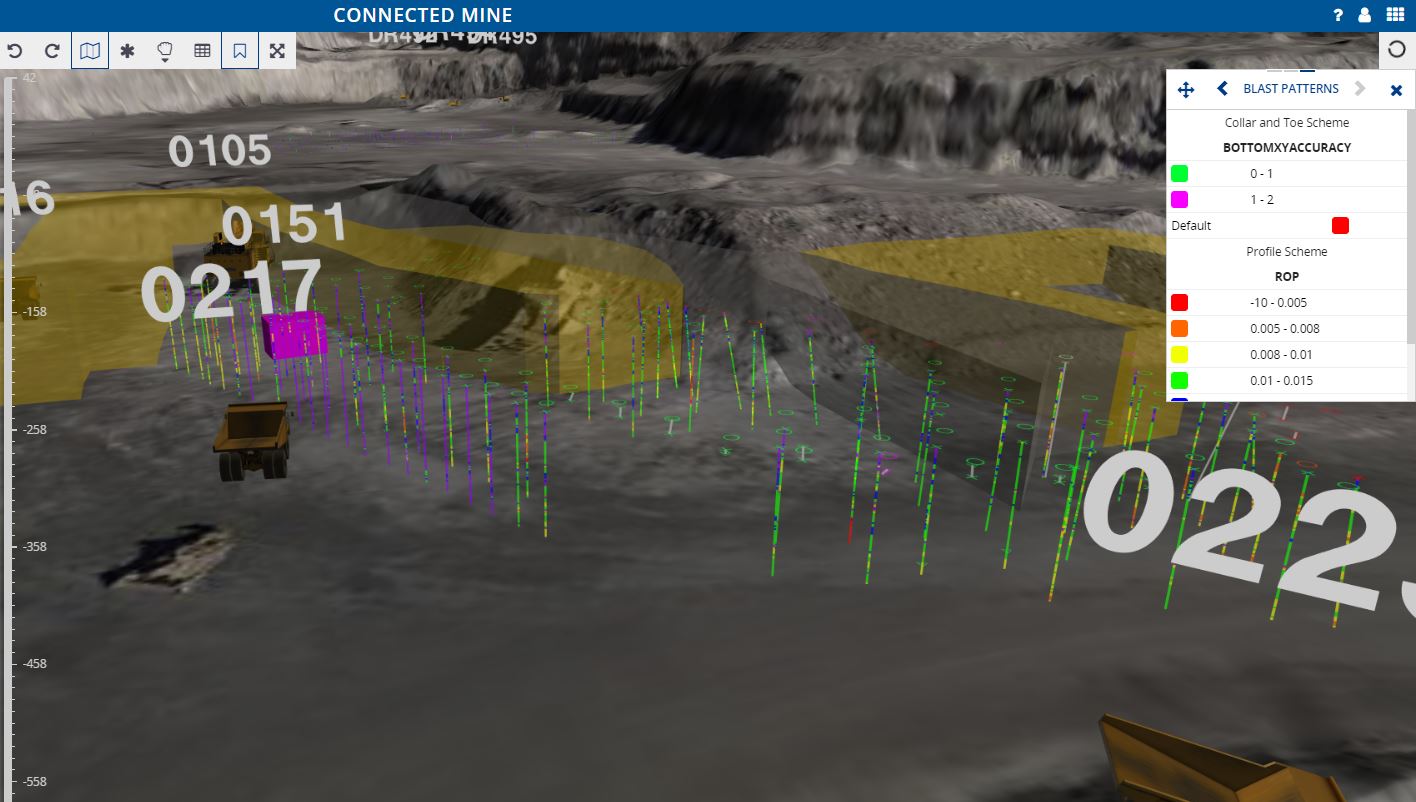
Drill holes coloured by penetration rate, with dig polygons and trucks
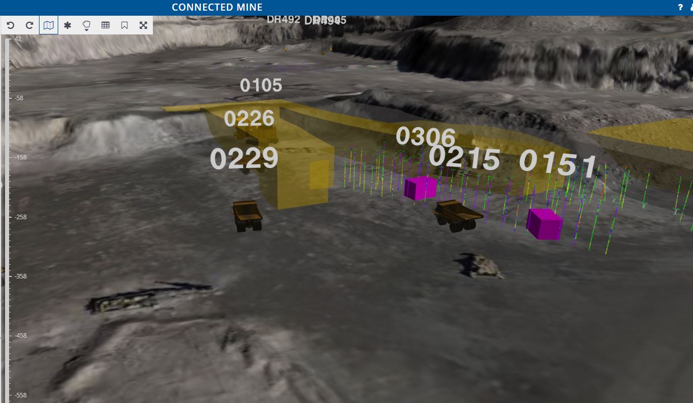
Trucks and loaders working within planned dig polygons
Replay the pit with every asset that has a time and a place.
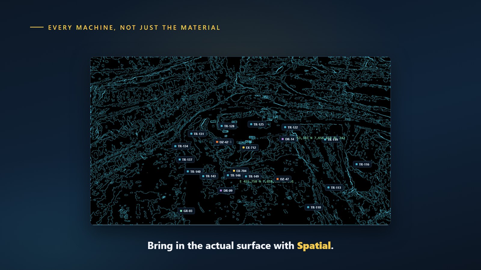
Every machine on the surface, not just the material
A digital twin of the pit that stays current, from the block model to product delivery.
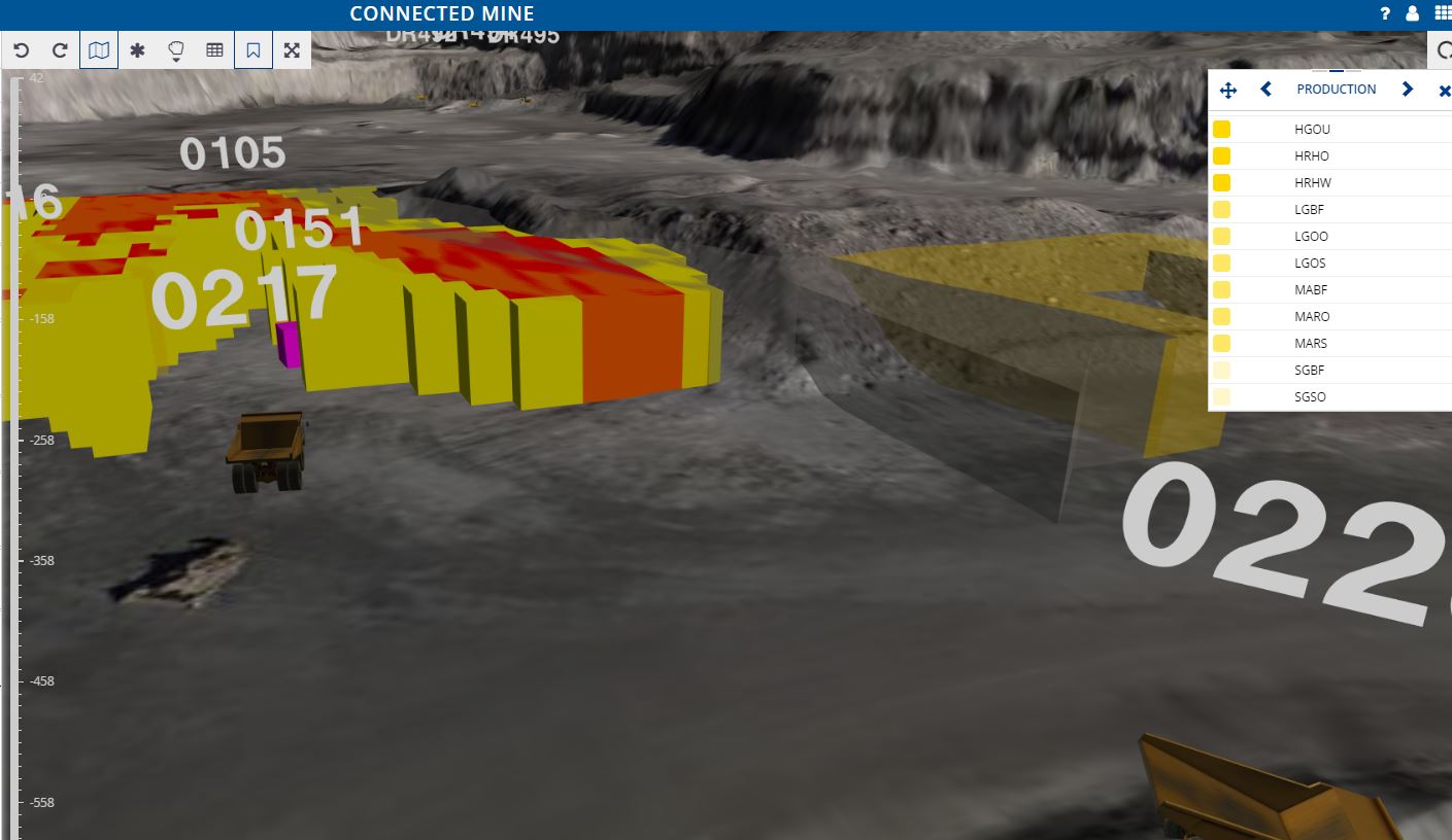
Block model coloured by material type, with haul trucks in the pit
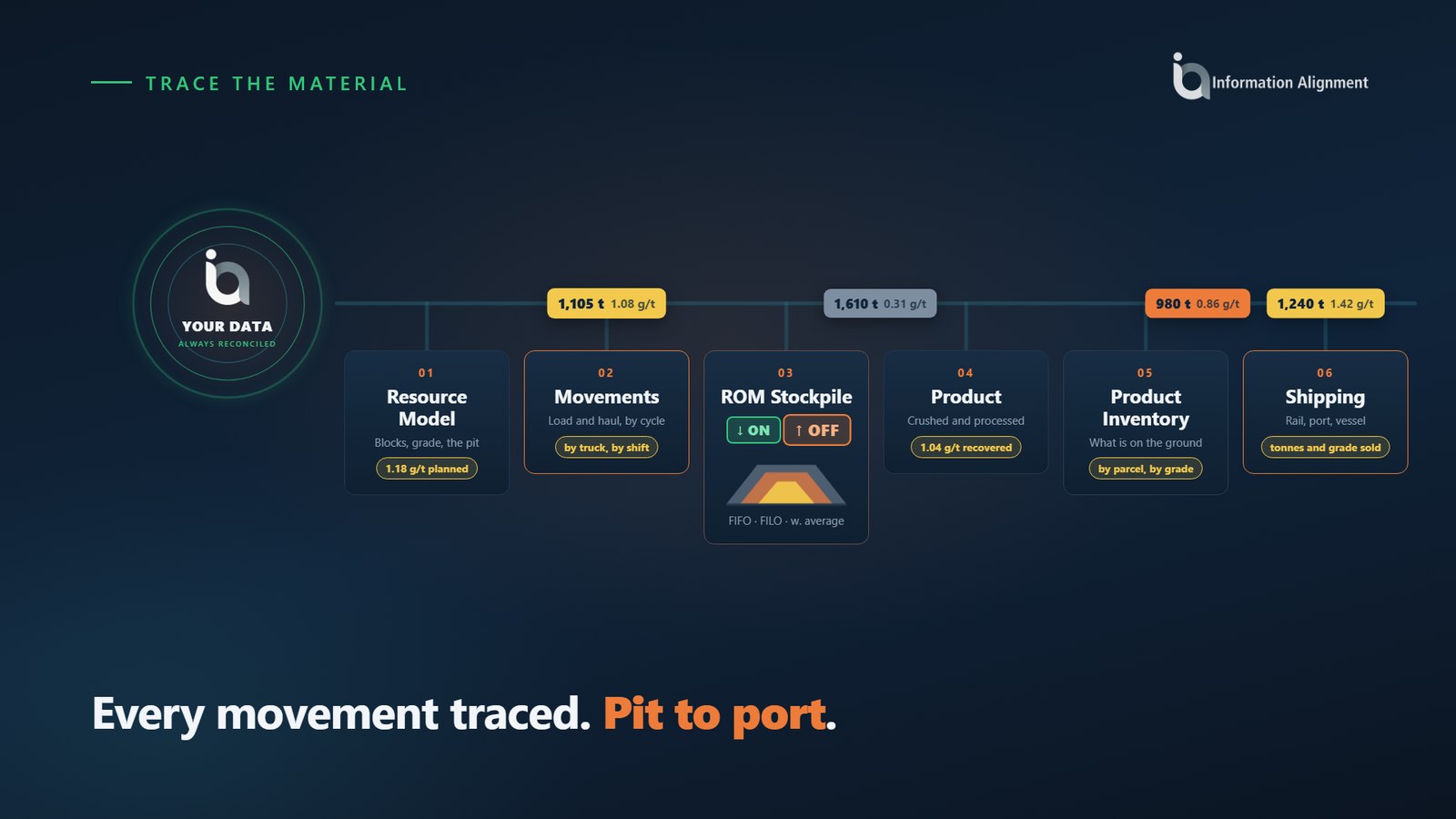
Material traced from the mine block through stockpiles and the plant to shipping
Spatial is not a separate picture of the mine. It is the same data, in its place and time.
A block’s history from drilling to blasting, mining and processing, in one place.
Equipment, blocks and measurements link back to the operational transactions behind them.
Combine spatial views with dashboards and charts, or use them standalone.
Plan effectively without spending hours in the pit. Show supervisors, engineers and managers the same picture of the operation.
What is Connected Spatial Intelligence?
Connected Spatial Intelligence is the spatial module of the Connected Mine platform. It shows operational and transactional data in a true temporal 4D view, so you can see what happened on the mine surface at any point in time.
What can it display?
The 4D mine surface, mine blocks and block models, drill holes and blast patterns, equipment replay from GPS, material movement arrows, and plant measurements at their location.
Where does the surface come from?
The mine surface can be updated in part or in full from a variety of sources, including survey and drone data, so the view reflects the pit at each point in time.
Can I replay a shift?
Yes. Equipment is animated from GPS coordinates and each position links to the operational records at that point in time.
Which devices does it run on?
It runs on PC, tablet and browser.
How does it fit with the rest of Connected Mine?
It uses the same validated data as Connected Mine Performance and Connected Process Performance, and spatial views can be combined with dashboards from Connected Data Analysis Services.
See your own drill, dig and haul data on the mine surface.