— MACHINE GUIDANCE SYSTEM
KNOW WHERE EVERY
MACHINE IS —
AND PROVE IT.
GuidEx gives every machine in your fleet precision GNSS guidance, live zone compliance, and a complete field record — whatever the job, wherever the site.


GuidEx gives every machine in your fleet precision GNSS guidance, live zone compliance, and a complete field record — whatever the job, wherever the site.
If your team is dealing with any of these in the field, you’re in the right place.
One breach of a permit boundary, heritage area, or exclusion zone can stop an entire project — with serious legal and safety consequences.
Every metre worked off-line is a metre you’ll pay to fix. Deviations from design add cost before any value is delivered.
No GPS-verified record of where machines worked, when, and for how long — leaving payout open to dispute.
Office has no live picture of machine positions, task status, or zone events until it’s too late to act.
Pre-work dependencies that slow mobilisation and add cost before a single productive machine move.
Survey-grade positioning accuracy — without the survey-grade price tag, specialist operator, or base station infrastructure.
GuidEx works across a range of industries and job types. Find yours below.
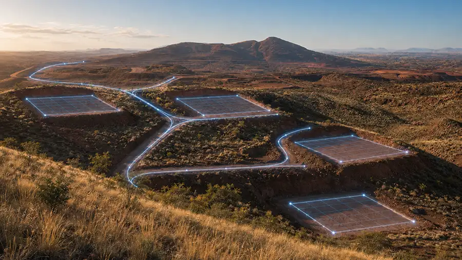
Navigate drill rigs and support machines to exact pad coordinates without ground stakes or advance survey crews. Reduce mobilisation delays, eliminate stakeout costs, and keep every machine inside permit boundaries.
▲ Navigate directly to drill pad coordinates — no physical stakes required.
▲ Import pad databases from CSV or XML — no manual entry in the field.
▲ Track pad completion status in real time, visible from the office.
▲ Exclusion zone alerts for heritage, environmental, and permit areas.
▲ GPS-verified activity logs for accurate contractor payout.
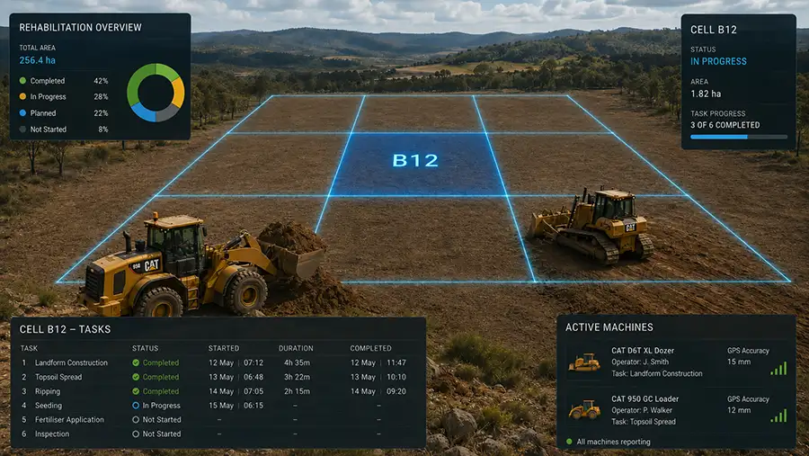
Give rehab crews the spatial awareness they need to work accurately within design grades and permit boundaries. Track task progress against each rehab area and maintain a defensible record for regulatory sign-off.
▲ Inclusion and exclusion zones define approved rehab areas and no-go boundaries.
▲ Audio-visual alerts keep operators within permitted treatment areas.
▲ Basic cut/fill display shows operator height above or below final design grade.
▲ Task tracking records completion status against each rehab area.
▲ GPS-verified logs provide an auditable record for regulators and approvals.
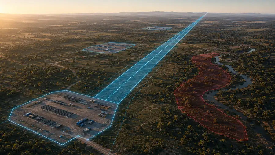
Keep civil machines on design from first disturbance to final grade. GuidEx installs on any machine in minutes and gives operators the positional awareness to work accurately without a survey crew on-site.
▲ First disturbance compliance — stay within approved construction corridors from day one.
▲ Cut/fill guidance shows operators their height relative to design grade.
▲ Exclusion and inclusion zones for environmental buffers and permit areas.
▲ Import design files via USB or over-the-air from the office.
▲ Machine pitch and roll monitoring with configurable threshold alerts.
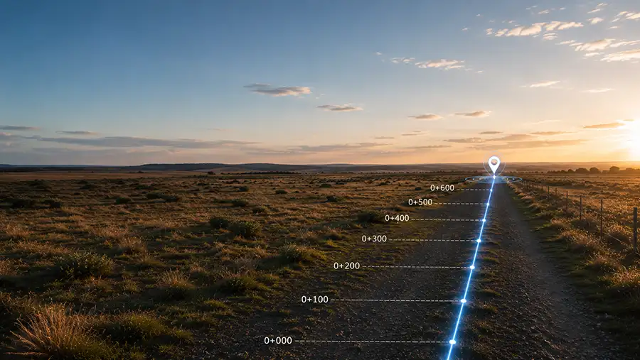
Keep clearing and support crews precisely on predefined seismic corridors without advance stakeout. Minimise environmental disturbance, maintain permit compliance, and complete surveys faster.
▲ Light bar guidance keeps machines on centreline along seismic lines.
▲ Visual and audible alarms when operators approach or breach corridor limits.
▲ Reduce unnecessary vegetation clearing outside approved corridors.
▲ Exclusion zones for heritage sites, watercourses, and environmental buffers.
▲ All machine positions logged for permit compliance records.
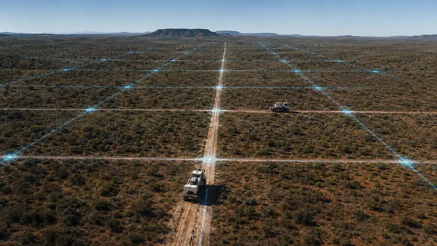
Guide machines along planting rows, harvest corridors, and treatment paths with precision. Maintain zone awareness across large areas and build a complete task record for every operation.
▲ Corridor and row guidance via integrated light bar — no manual flagging.
▲ Exclusion and inclusion zones for riparian areas, native vegetation, and buffer zones.
▲ Audio-visual alerts when operators approach zone boundaries.
▲ Task tracking logs treatment area coverage and completion status.
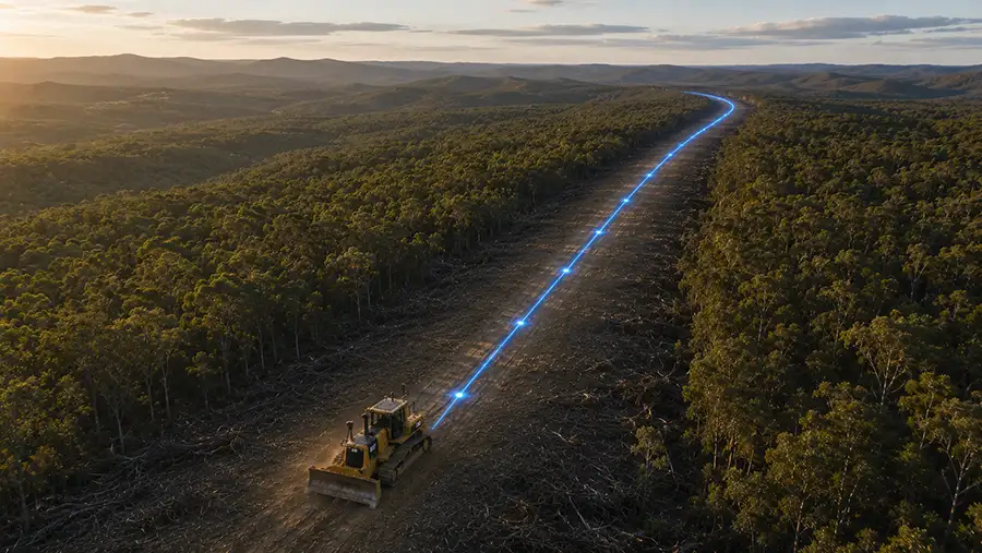
▲ Firebreak construction and maintenance — stay on the line, every pass.
▲ Infrastructure vegetation control along powerlines, pipelines, and easements.
Answer three quick questions and we’ll point you to the right hardware and correction setup.
Every GuidEx system is built on Trimble hardware — rugged, accurate, and supported. Mix and match components to match your application and correction environment.
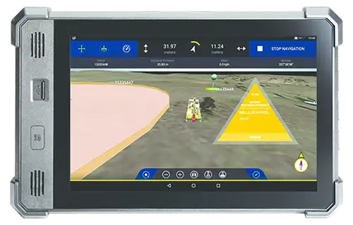
10.1″ rugged Android touch display — the operator interface for all GuidEx tiers.
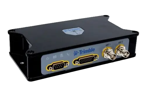
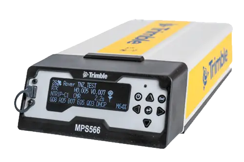
Advanced modular receiver with integrated UHF radio and 4G LTE modem — no separate radio unit required.
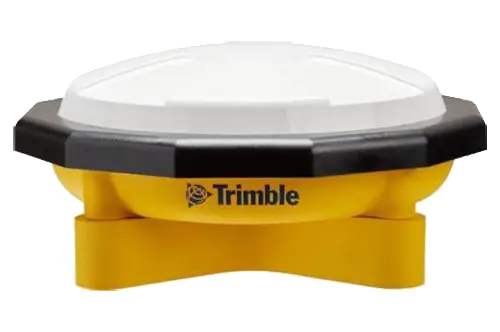
High-performance field antenna built for shock and vibration environments.
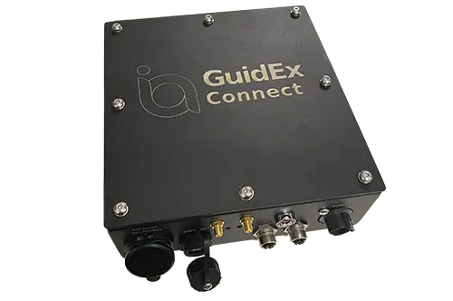
Industrial LTE router providing internet connectivity for GuidEx cloud services, NTRIP corrections, and live machine tracking in remote environments.
GuidEx is supported by people who have helped shape the product. Whether you’re out in the field or in the office, our support team can get you going.
▲ Support covers hardware and software, not just one or the other.
▲ Direct access to technical support — email support@upgsolutions.com
▲ Nationwide support centers. Your timezone — covered.
▲ Training available on-site or remote.
How long does installation and calibration take in the field?
GuidEx is designed for quick field deployment, with installation and commissioning taking as little as half a day for GuidEx Core installs. Contact us for specific timing estimates for your vehicle type.
What GNSS accuracy does GuidEx achieve?
GuidEx utilises common correction methods to achieve accuracies tailored to your requirements, including Trimble RTX for corrections in areas without infrastructure. Expect decimeter to centimeter accuracy depending on hardware options.
Can it work on both UTVs and heavy equipment?
Yes — this is one of GuidEx’s key advantages. The same system installs on LVs, mulchers, tracked machines, and other heavy equipment. One consistent platform across your mixed fleet, with the same interface and reporting on all vehicles.
How is contractor activity tracked and verified?
GuidEx logs machine position, time, speed, heading, and GNSS quality continuously. Logs sync to the office daily. User-defined event triggers allow task-specific tracking, creating GPS-verified activity records for accurate contractor payout.
Can GuidEx use our existing GIS shapefiles?
Yes. GuidEx supports Point, Line and Polygon shapefiles, with the latter being configurable as either exclusion or inclusion zones. It also accepts DEMs, CSV target coordinates, and aerial imagery — so your existing spatial data works from day one.
Does it work without internet in remote areas?
Yes. GuidEx operates fully offline in the field. Data updates can be pushed to machines via USB. An optional modem supports cell and Wi-Fi where available, and UHF radio is used for RTK in remote locations without mobile coverage.
What support and training is available?
On-site or remote diagnostics of hardware, as well as webex or in-person training sessions of GuidEx Field and GuidEx Office software can be arranged by contacting us.
How does GuidEx compare to traditional survey stakeout?
Traditional stakeout requires a survey crew to physically mark targets before machines can move. GuidEx eliminates this step entirely — operators navigate directly to coordinates, saving the time and cost of advance survey operations on every project.
Talk to our team about your specific application — seismic, drilling, corridor, or civil.
Talk to our team about your specific application — seismic, drilling, corridor, or civil.